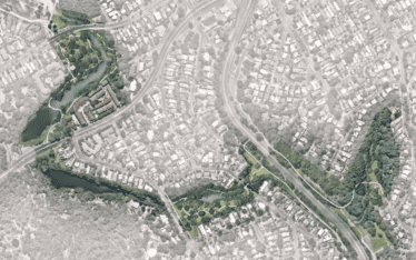
Creek Naturalisation Options
Nature based solutions were developed to improve Flat Rock Creek following detailed technical assessments and community engagement....
Nature based solutions were developed to improve Flat Rock Creek following detailed technical assessments and community engagement....
Assess the water quality implications of the Pulgul Sewage Treatment Plant capacity upgrade works...
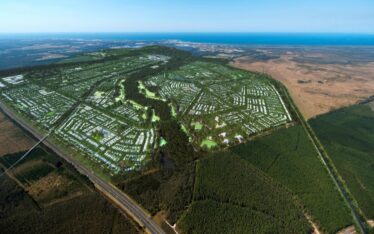
Conceptualise and design the integrated water cycle management regime for Aura...
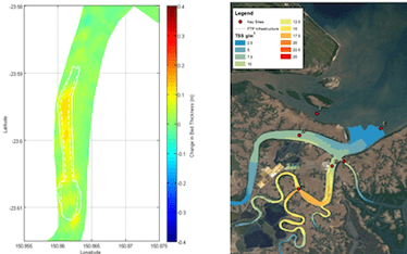
Fitzroy Terminal – Hydrodynamic and Sediment Transport Impact Assessments...
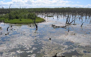
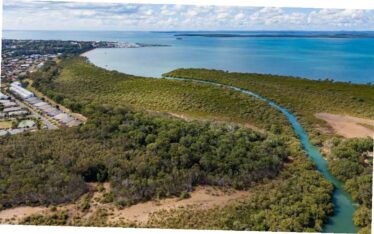
Water quality monitoring of the Boondall Wetlands...
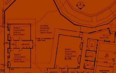
Stormwater Management Plan and Flood Impact Assessment for a proposed child care facility...
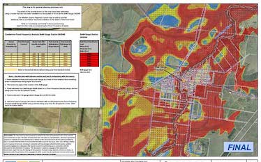
Widespread flooding occurred over large areas of Queensland in December 2010 and January 2011. On the 17th January 2011 a Commission of Inquiry into the Queensland Floods of 2010/2011 was established (termed the Queensland Flood Commission of Inquiry (QFCI)). The QFCI released its final report on 16 March 2012....

Water Technology has provided specialist flood analysis and design services for the Heritage Estate Residential Development located on Foxwell Road in Coomera, Gold Coast....