Water Monitoring and Management via WaterSENSE
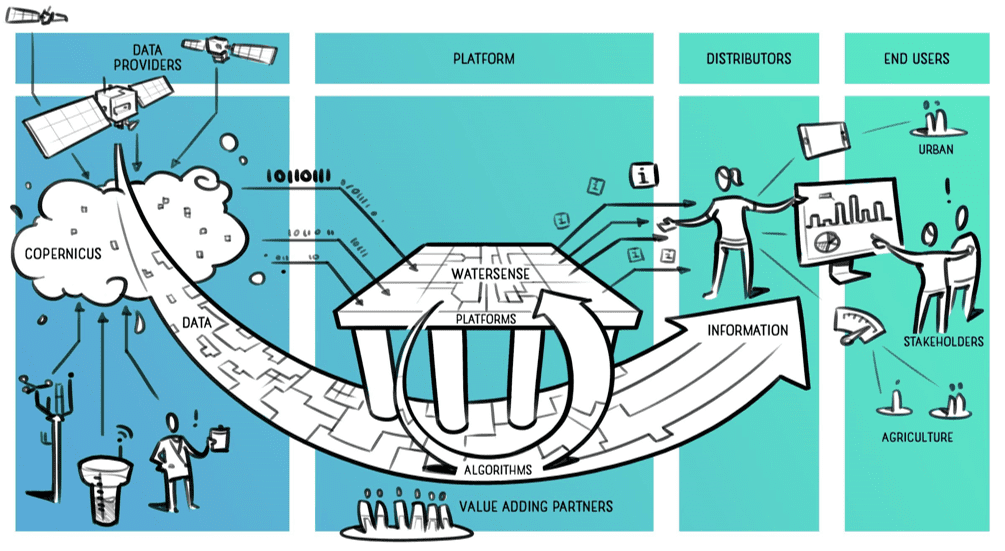
WaterSENSE aims to set up a water monitoring system and toolbox, as bulleted below, to provide water availability and mapping services and hassle-free access to the information needed to support decisions, cooperate, share, collaborate and report for any place in the world at a different time and spatial resolutions, based on earth observation data, hydrological models and local field data.
The toolbox concept of WaterSENSE is:
-
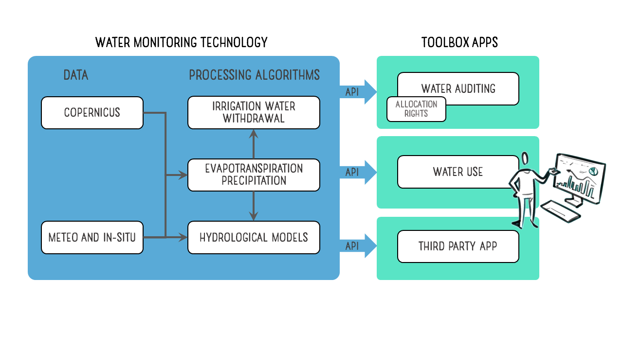
- Water Monitoring System: Modular, operational, water monitoring system: Integrates Copernicus EO data, ground radar, models, in-situ data, and novel research.
- Water Management Toolbox: Makes data, algorithms and services available to users. Various Apps provide reliable, actionable Information.
- Flexible Service Subscription models.
- Flexible Front Ends
Functional elements of WaterSENSE:
- Open Algorithms
- Independent
- Value Added Services
- Scalable data (sub field to Global)
- Scalable processing
- Operational (automated processing facility)
- Supported and maintained
WaterSENSE is a collaborative project between consortium partners connecting platforms through service buses using open standards.
The WaterSENSE consortium consists of 7 partners: eLEAF BV (Netherlands), Hydrologic Research (Netherlands), Water Technology (Australia), Hidromod (Portugal), hydro & meteo GmbH (Germany), The University of Sydney (Australia) and HCP International (Netherlands).