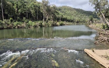
Wujal Wujal Master Plan Review
Combining local knowledge, land suitability analysis and climate adaptation frameworks that will lead to enduring recovery pathways for a remote community...
Combining local knowledge, land suitability analysis and climate adaptation frameworks that will lead to enduring recovery pathways for a remote community...
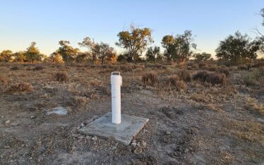
Supporting the review and installation of new observation bores on the Pike Floodplain to help monitor the effectiveness of environmental watering...
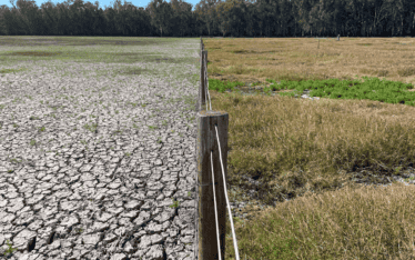
Extensive and ongoing field studies to map the distribution and cover of threatened wetland-dependent species and trial of propagation methods...
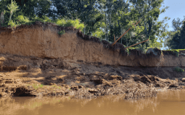
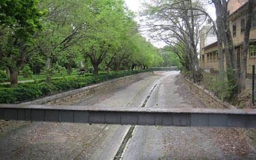
A management approach for the ongoing erosion of Stanley River was developed based on site assessments, modelling and detailed designs...
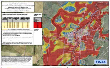
Bendigo Urban Flood Modelling Project....
Flood risk assessment and mapping of the Kingston municipality...

Stormwater Management Plan and Flood Impact Assessment for a proposed child care facility...
Widespread flooding occurred over large areas of Queensland in December 2010 and January 2011. On the 17th January 2011 a Commission of Inquiry into the Queensland Floods of 2010/2011 was established (termed the Queensland Flood Commission of Inquiry (QFCI)). The QFCI released its final report on 16 March 2012....