Using Palaeoflood Hydrology to Inform Improvements to Paradise Dam
Using palaeohydrologic information to inform improvements to Paradise Dam...
Due to its geography, Western Sydney experiences significantly higher temperatures than coastal Sydney. At the same time, its green spaces are rapidly urbanising. While the impacts of heat are already being felt across the area, heat hazard is often overlooked in climate change adaptation and planning response as an ‘invisible’ climate risk.
The Western Sydney Regional Organisation of Councils (WSROC) represents and advocates for the diverse local communities in Greater Western Sydney, including the member councils of Blacktown City Council, Blue Mountains City Council, Cumberland City Council, Hawkesbury City Council, Lithgow City Council and Liverpool City Council. WSROC is also a leader in planning for and building resilience against heat risk.
WSROC appointed Water Technology to develop and pilot a place-based heatwave risk assessment and mapping methodology.
Investigating extreme heat vulnerability and mitigation approaches across the Greater Western Sydney Area
Western Sydney New South Wales
Western Sydney Regional Organisation of Councils
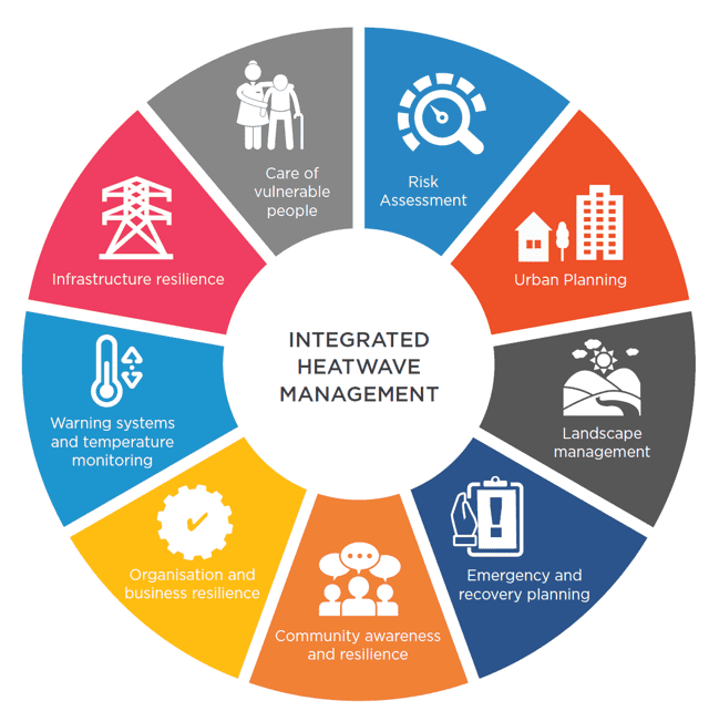

A co-design process with Local and State Government organisations was used to develop the methodology which incorporated:
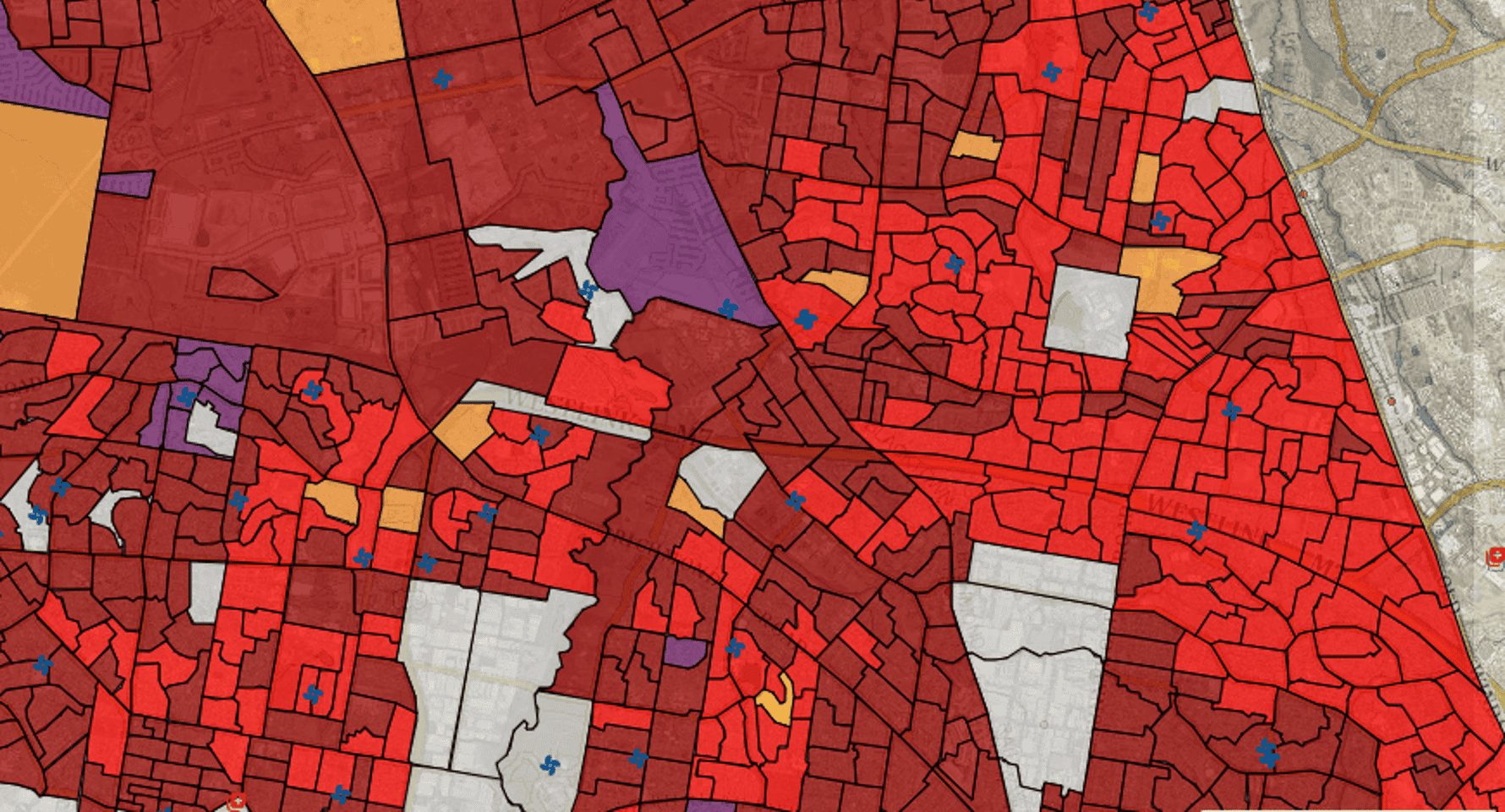
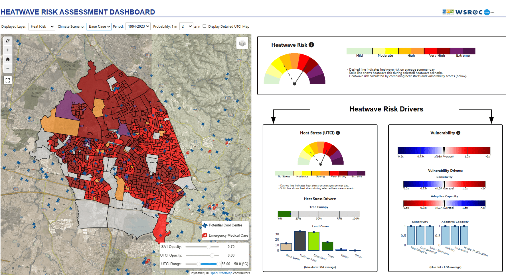
The methodology was piloted by three selected Councils in NSW: Blacktown, Hawkesbury and Willoughby. These were chosen because they represent a variety of urban and rural landscapes and present different geographic settings (coastal vs inland). This helped ensure that the methodology developed could be applied to virtually any Local Government Area in NSW without having to undergo any structural amendments. The outcome was a methodology which provides a systematic approach to assess, map and prioritise heatwave risk in NSW Local Government Areas, with a focus on community health and wellbeing.
An interactive data visualisation dashboard was also prepared as part of the project. The methodology enables Councils to routinely assess the effectiveness of measures put in place to reduce local heatwave risk. The Heatwave Risk Assessment methodology was presented by Water Technology at the launch of the Greater Sydney Heat Smart City Plan 2025-2030 in December 2024,
and received interest from multiple stakeholders including local and state government. Options to roll-out the methodology to more NSW Councils are being investigated.
Using palaeohydrologic information to inform improvements to Paradise Dam...

Assessing the availability of water resources for potential hydrogen production...
Assessing the effects of environmental watering on groundwater and vegetation health...
