Restoring the Banks of Waterways in the Shoalhaven Region
Water Technology assessed the extent of bank erosion and determined the feasibility of bank treatment options...
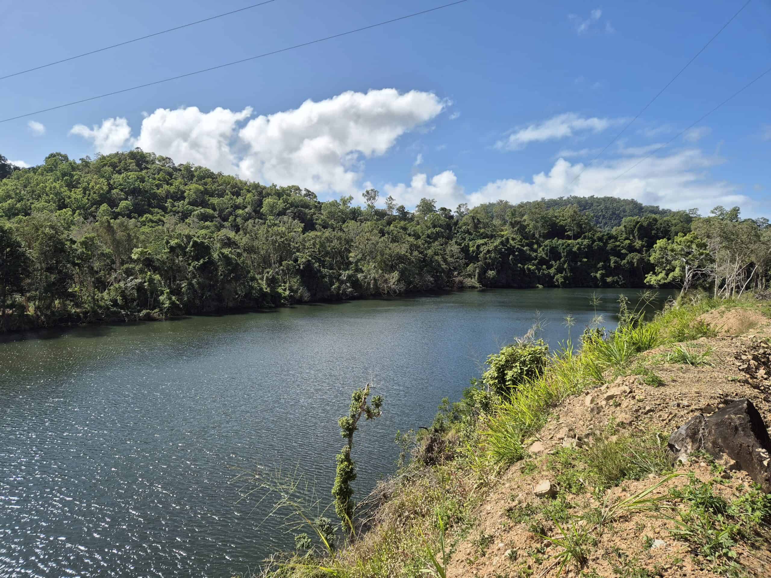
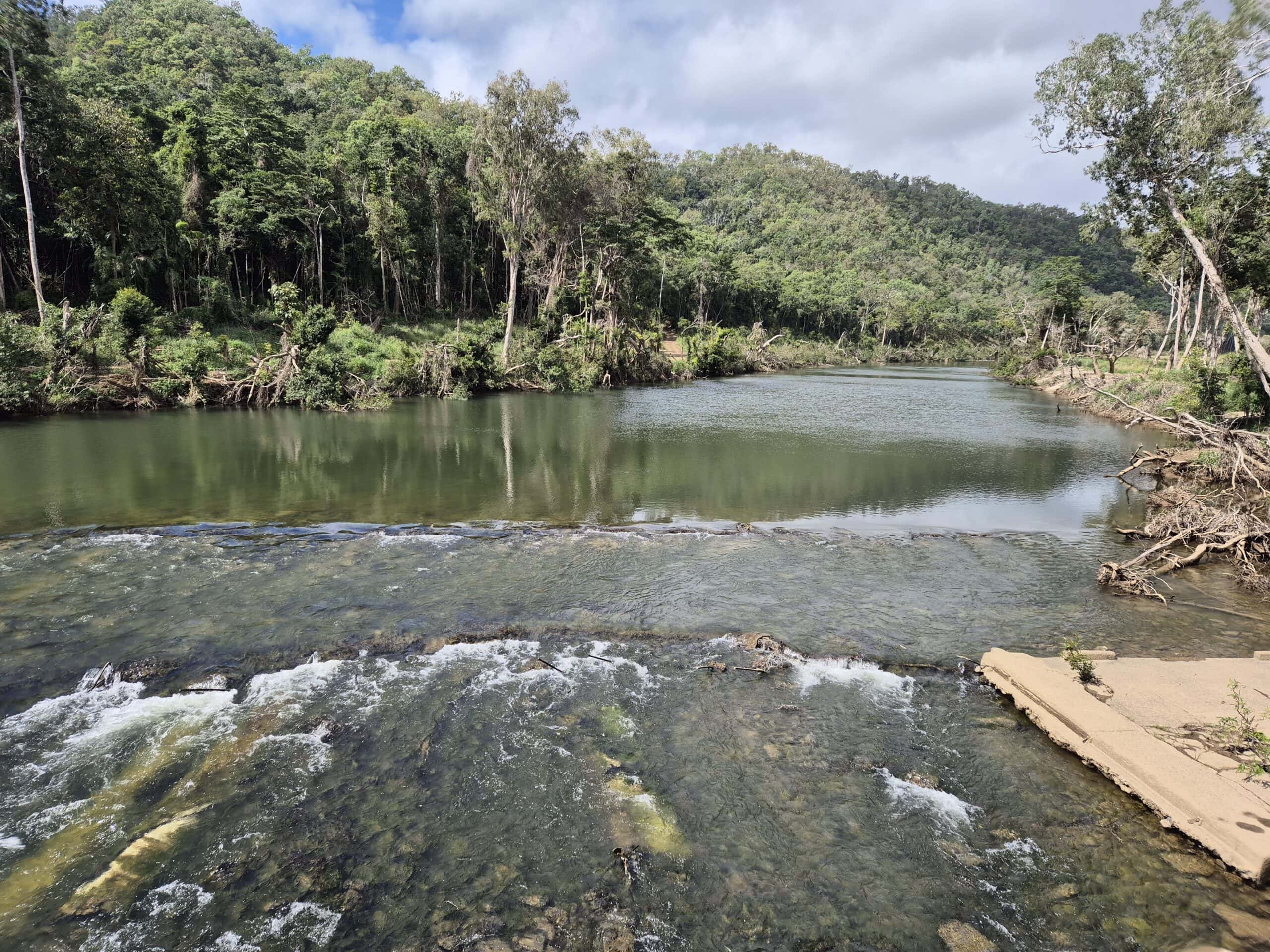
The Wujal Wujal township is located on Eastern Kuku Yalanji Country, on the western bank of the Bloomfield River within the wet tropics of Far North Queensland, between Cairns and Cooktown. The Wujal Wujal area has experienced flood events in the past which have significantly impacted the community and its surrounds. The most recent flood event resulted from Tropical Cyclone Jasper in December 2023 which required emergency services to evacuate 300 residents. The flooding caused extensive damage to homes and critical community infrastructure. The town is limited with regards to available evacuation routes and is subject to early inundation of local roads. During the December 2023 flood event, some residents were able to evacuate via the road to Cooktown. Others had to wait over a week to be airlifted out. After 120 days, residents were able to return.
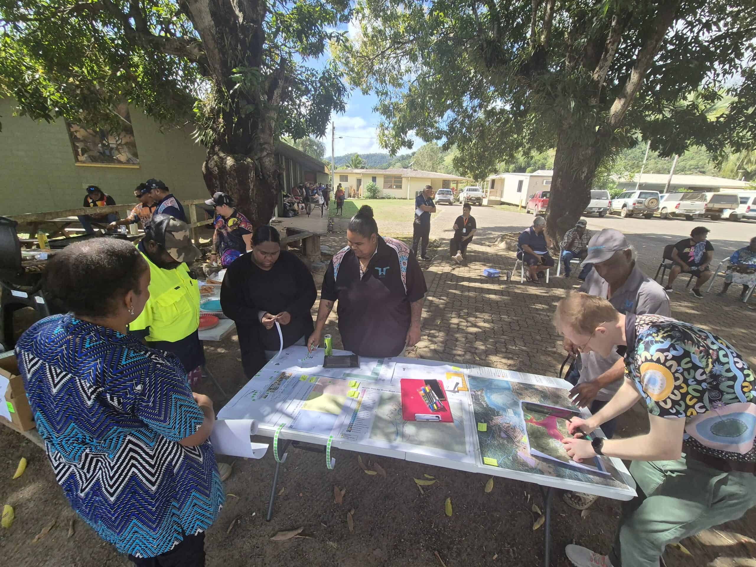
Following the devastation of Tropical Cyclone Jasper, Meridian Urban and Water Technology worked in close collaboration with the Wujal Wujal Aboriginal Shire Council and community members to reimagine a safer and more sustainable growth strategy for the township.
Combine local knowledge with technical assessments to develop adaptation and mitigation options for the immediate, short and long term
Wujal Wujal Queensland
Wujal Wujal Aboriginal Shire Council
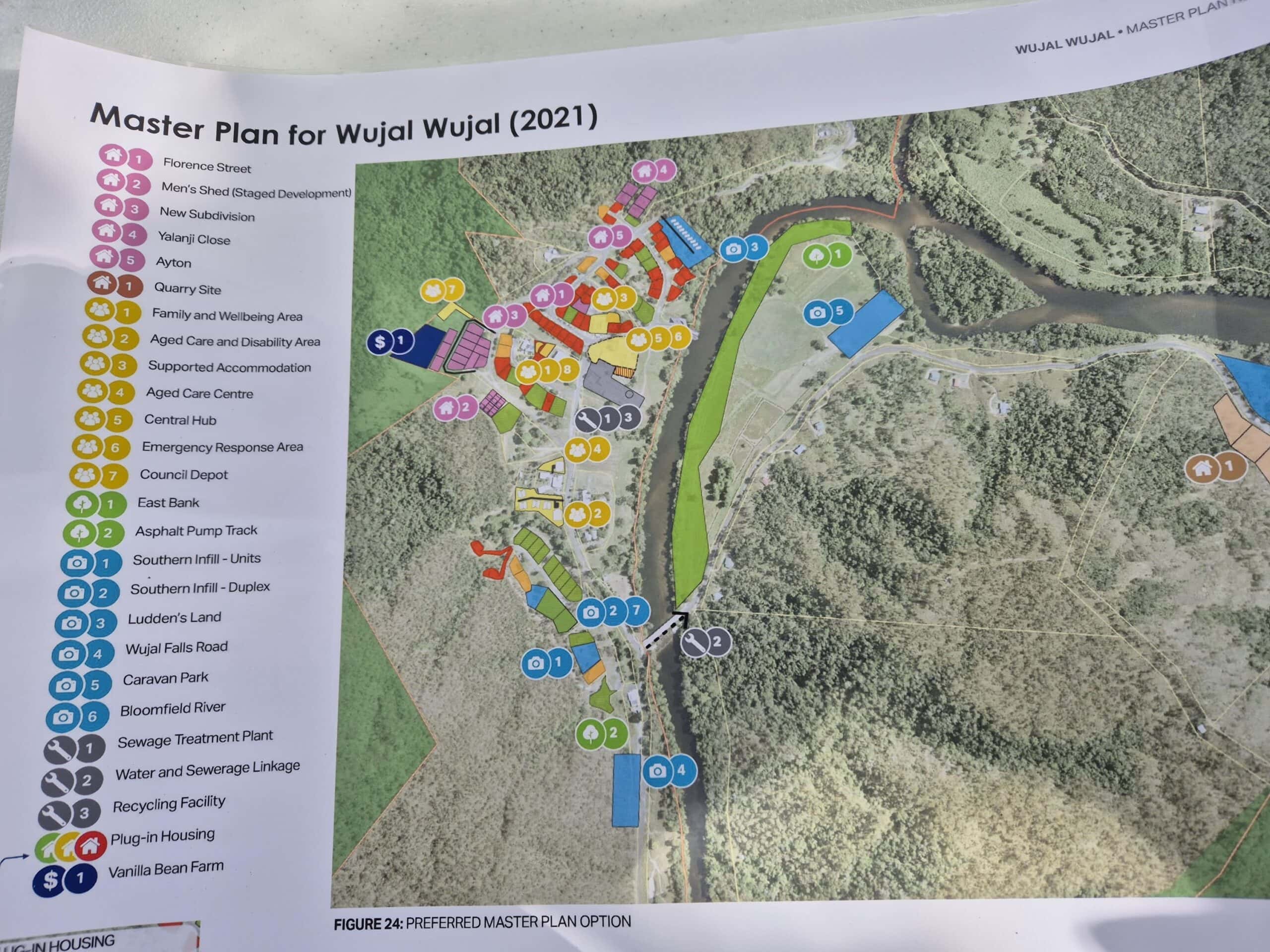
The project involved a review of the existing Wujal Wujal Master Plan to ensure that the plan remains contemporary to emergent issues and that it considers the significant flooding following Tropical Cyclone Jasper.
The first round of consultation with the community was undertaken in July 2024. Water Technology’s flood expert, Andrew Thompson, joined the Project Team and members of Queensland State Government to set up a drop in session and yarning circle with the local community.
A technical assessment was then undertaken including a flood risk assessment which utilised the best available data and knowledge from historical flooding events and considered the consequences of hazards on people, property and infrastructure. Hydraulic modelling of riverine and overland flow flooding provided information on flood hazard in Wujal Wujal.
A long list of adaptation and mitigation options were developed combining the technical inputs, land suitability model and consultation findings. Each option included high level details on cost, benefits, adverse impacts and effectiveness. The projects and outcomes that were developed through the process are supported by a series of actions to be undertaken over the immediate, short and long term.
Combining local knowledge, land suitability analysis, and climate adaptation frameworks can lead to enduring recovery pathways for remote communities, like Wujal Wujal.
Water Technology assessed the extent of bank erosion and determined the feasibility of bank treatment options...
Water Technology supported the development of the innovative mangrove wetland, from the vision to the conceptual design through to monitoring post construction...
Water Technology provided support with the design and certification of oyster reef installations, in addition to monitoring and recording changes in the upstream and downstream locations of the oyster reefs...